Karpaseia (Karpáseia)
Karpaseia or Karpasha (Kαρπάσια []; Karpaşa) is a village in Cyprus, 2 km south of Myrtou. De facto, it is under the control of Northern Cyprus.
Karpaseia is the smallest village in population amongst the Maronite villages. In 1778, there were 99 inhabitants; in 1973, they numbered 245. Today, only eleven enclaved Maronites remain in Karpaseia, the rest having fled to the south during the 1974 Turkish invasion.
The village church is dedicated to the Holy Cross. Inside the church, there are remnants of wall paintings. The icons date from the 17th century. There are also two ancient wooden crosses of great value: one is Byzantine and dates from the 15th century; the other is rustic Cypriot-Byzantine and dates from the 17th century. The two crosses constitute one of the most important possessions of the Maronite community, which celebrates the protector of the village on 14 September, the day on which St. Helen is said to have found the Holy Cross (14 September 320 A.C.).
Map - Karpaseia (Karpáseia)
Map
Country - Cyprus
 |
 |
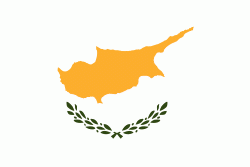
| Flag of Cyprus | |
The earliest known human activity on the island dates to around the 10th millennium BC. Archaeological remains include the well-preserved ruins from the Hellenistic period such as Salamis and Kourion, and Cyprus is home to some of the oldest water wells in the world. Cyprus was settled by Mycenaean Greeks in two waves in the 2nd millennium BC. As a strategic location in the Eastern Mediterranean, it was subsequently occupied by several major powers, including the empires of the Assyrians, Egyptians and Persians, from whom the island was seized in 333 BC by Alexander the Great. Subsequent rule by Ptolemaic Egypt, the Classical and Eastern Roman Empire, Arab caliphates for a short period, the French Lusignan dynasty and the Venetians was followed by over three centuries of Ottoman rule between 1571 and 1878 (de jure until 1914).
Currency / Language
| ISO | Currency | Symbol | Significant figures |
|---|---|---|---|
| EUR | Euro | € | 2 |
| ISO | Language |
|---|---|
| EN | English language |
| EL | Greek language |
| TR | Turkish language |


